Indoor navigation: How it works, technologies and benefits
Last Updated
Oct 07, 2026
Published On
Aug 27, 2026
 39
39
Table of Contents
TL;DR
Indoor navigation is a technique that helps people reach destinations inside complex buildings or premises. It is mainly useful in large shopping malls, event venues, universities, and hospitals. Technologies such as Bluetooth, Wi-Fi, and Ultra-Wideband (UWB) play an important role in indoor navigation solutions by enabling positioning and navigation.
Whether it’s about attending an event or exploring a shopping mall, finding your desired location is very challenging. Unfortunately, GPS tracking isn’t always reliable in such a situation either. The maze-like structures confuse you, and it takes a long time to reach your correct endpoint.
That’s where indoor navigation comes in. It allows visitors to explore the place and guides them to the correct location. Many organizations are adopting this technology to increase their foot traffic.
According to a Grand View Research report, the global indoor positioning and navigation market size is expected to reach USD 174.0 billion by 2030. This highlights the growing demand for indoor navigation in the current business environment.
However, many professionals and the public are unaware of what an indoor navigation solution is. Taking this into consideration, we’ll explore everything about it, including its working concept, benefits, and use cases.
📌 Key Takeaways
- Indoor navigation helps people reach their desired destination within a complex building.
- Wi-Fi, UWB, Bluetooth, and inertial navigation systems are the key technologies in an indoor navigation solution.
- The technique is widely useful in exhibition centers, hospitals, airports, shopping malls, and universities.
- The technology is equally valuable for organizations and attendees or visitors.
- Using mobile apps such as YourMap by Moon, users can enhance their indoor navigation experience.
What is indoor navigation?
Indoor navigation refers to a technology-based system that provides real-time directions to visitors in complex buildings and other indoor spaces.
In these environments, traditional GPS may not provide accurate navigation because the signals are often weak or unavailable. In such conditions, an indoor navigation solution serves as a digital map that provides step-by-step guidance to users so they reach the correct destination.
Unlike GPS, which relies on satellite signals, an indoor navigation system uses specific technologies. These technologies are easily operable in indoor spaces. However, walls and other obstacles may affect the signal strength.
How do indoor navigation systems work?
An indoor navigation system uses technologies such as Bluetooth, Wi-Fi, smartphone sensors, and UWB. These technologies track the user’s position and guide them. The typical workflow of the system is as follows:
- Creating a digital map: A digital map of a building is created that covers staircases, rooms, corridors, and entrances. This kind of mapping shows the building layout in digital form.
- Determining the user’s location: Technologies such as Bluetooth beacons, Wi-Fi, and other sensors estimate the user’s location. These technologies collect positioning data to determine the user’s position and location.
- Analyzing the best route: The navigation solution calculates a suitable route for the user. It compares the user’s current location and selected destination.
- Guide direction and update when required: The system provides visual instructions to help the user move towards their desired destination. In some systems, these instructions get updated automatically. It means routes are updated when the user changes paths or when a route is temporarily unavailable.
Looking for the right navigation solution?
Try YourMap by Moon and help your visitors reach you in complex indoor spaces.
Try It Now
What are the key elements in indoor navigation?
Indoor navigation doesn’t rely on the standard GPS; it is based on several concepts. Here are the core elements that power this system.
Indoor positioning system (IPS)
An indoor positioning system (IPS) is a technology that tracks the location of users or objects in a complex indoor environment. It uses technologies such as Wi-Fi, UWB, and Bluetooth to estimate the positions of objects in indoor environments.
Indoor mapping
Indoor mapping involves creating digital maps of indoor spaces. It showcases important details such as floors, stalls, the help desks, and other points of interest. For instance, a shopping mall map shows entrances, shops, stairs, restrooms, and more.
Turn-by-turn directions
Turn-by-turn directions provide instructions to the user. This helps them to reach the specific location. ‘Turn left,’ ‘take a right turn,’ or ‘continue straight’ are such instructions in this concept. These instructions provide real-time directions, eliminating confusion for the user.
Dynamic wayfinding
Dynamic wayfinding offers flexible, real-time route options to help the user find the destination. Therefore, it suggests the most suitable path for the user based on the surrounding changes. This concept ensures that the user receives accurate directions as conditions change.
What are the types of indoor navigation technologies?
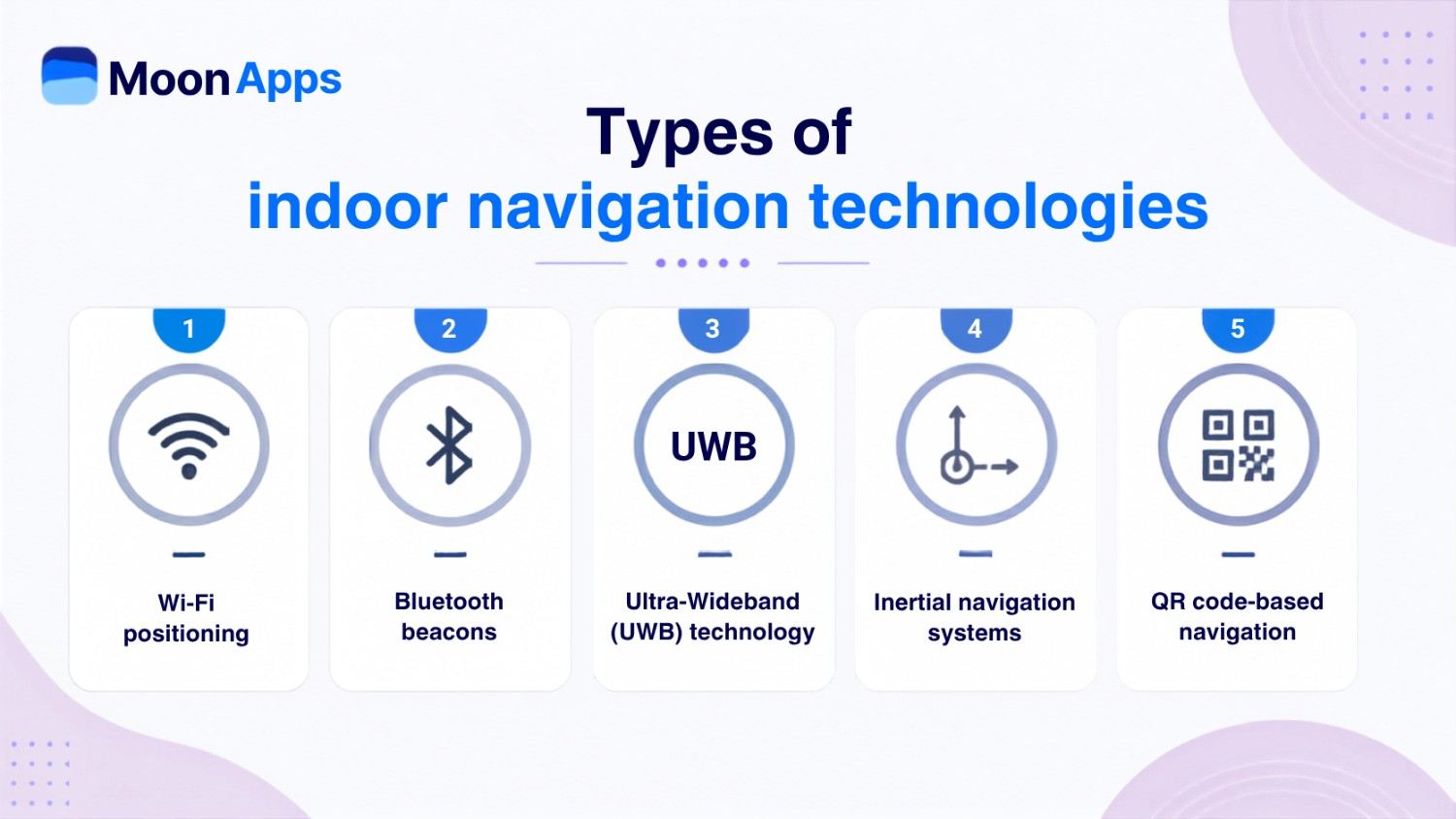
Various technologies are used by indoor navigation systems, which are as follows:
Wi-Fi positioning
In this technology, Wi-Fi signals are used to determine the location of the user’s device. Various factors, such as signal patterns, signal strength, and access point locations, play an important role in estimating the device’s position. It is a cost-effective method commonly used in buildings with Wi-Fi installed.
Bluetooth beacons
Bluetooth beacons are small wireless transmitters that use Bluetooth Low Energy (BLE) to detect the user’s location. These transmitters are placed at fixed locations in the building. Similar to Wi-Fi positioning, these are cost-effective. Beacons continuously broadcast Bluetooth signals, and the user’s smartphone detects the nearby beacon. In this way, it estimates the user’s location based on detected signals.
Ultra-Wideband (UWB) technology
It is one of the widely used indoor navigation technologies when accuracy is a major concern. It uses short radio pulses to measure the distance between devices and determine their position. The UWB anchors are installed at fixed locations, and a compatible device communicates with them. The system then measures the time it takes for the signals to travel between the devices. It uses this information to estimate their distance and position.
Inertial navigation systems
Inertial navigation systems use sensors such as gyroscopes and accelerometers. These sensors estimate the user’s movement and position. The systems do not rely on external signals, making them ideal for indoor navigation.
QR code-based navigation
This technology is mainly used at the entrance gate, kiosks, or other designated locations. Visitors scan a QR code to get a map or a navigational interface. The system can then provide directions from the known scan location to the destination. Unlike Bluetooth beacons and UWB technology, it doesn’t support automatic positioning.
What are the benefits of an indoor navigation system?
An indoor navigation system is equally helpful for businesses and their visitors. Organizations streamline their visits, and users find it convenient to reach their destination. Here are some advantages of indoor navigation:
For businesses and organizations
- Enhance customer experience by allowing visitors to explore products and services.
- Indoor navigation guides the visitor to the right route. This ultimately increases the visitors’ foot traffic for the business.
- Helps visitors find the best route to reach the destination. This reduces the workload on the staff.
- Businesses can save money by reducing the need for manual assistance.
- Businesses can enhance their branding and image by enabling visitors to navigate smoothly to their destination.
For visitors
- Provides easy, real-time directions through the complex indoor structure.
- Reduces the user’s confusion during visits to unfamiliar buildings and areas.
- Indoor navigation saves users time by eliminating the need to search for the destination.
- Provides full convenience to users during their visit to shopping malls, campuses, and hospitals.
- Customers can explore stores, products, services, and other points of interest.
What are some real-life use cases of indoor navigation?
There are numerous real-life use cases where indoor navigation is widely used. Some of them are as follows:
Hospitals
Large hospitals have complex, confusing interior layouts with numerous departments. Incoming patients and other people often find it difficult to reach their destinations. This is where indoor navigation is highly useful, guiding visitors along the right route. It also reduces staff workload and allows them to locate equipment and emergency areas.
Museums and exhibitions
An indoor navigation solution helps tourists navigate the large museum buildings with ease. It provides an efficient route to reach their point of interest. Also, tourists can explore and access additional information through the smart guide.
Shopping malls
Large shopping malls with a maze-like structure can confuse visitors. The indoor positioning system helps customers find their way to the store, restrooms, amenities, and other places. This saves their time and lets the customer explore various spaces. It guides customers and helps businesses increase foot traffic.
Large business centers
Indoor navigation is also helpful in large business centers. It helps visitors reach their destinations efficiently. Businesses can provide a better visitor experience, leaving a lasting impression.
Navigate with ease using YourMap by Moon
YourMap by Moon is a simple-to-use navigation application that integrates with Google Maps. It simplifies indoor and outdoor navigation for users and visitors and helps businesses increase foot traffic. You can easily explore events and places in your region.
Whether it is an event, a university campus, or a museum, this navigation solution lets you explore and find an efficient route. You can reach the specific stall, shop, or booth with this handy app. Likewise, you can easily navigate to the entrance or exit gate, parking areas, or any outdoor zone. Search for events or places by typing or voice command.
Event planners and other organizations can create custom event maps to let their visitors easily navigate their destination. Moreover, they can share the relevant QR codes with their visitors so they can reach their target location by scanning them. Users can bookmark their favorite events and save them directly to their calendar.
The app includes a built-in audio guide that provides the right navigational information about the place. You can simply explore nearby points of interest, such as hotels, restaurants, shopping areas, and parks.
YourMap is your reliable navigation guide. Whether it is about universities, events, hospitals, sports complexes, or museums, the app provides accurate maps. It’s easy, quick, and reliable.
Don’t let complex layouts slow you down.
Ease your navigation with YourMap by Moon. Explore interactive maps and find your destination quickly.
Download Now
FAQs
Indoor positioning and indoor navigation are related but serve different purposes. In simple terms, positioning relies on UWB, Wi-Fi, and Bluetooth beacons to determine your location. On the other hand, navigation focuses on route guidance and wayfinding, telling you how to get somewhere.
The major differences between indoor and outdoor navigation systems lie in their use and the technologies they rely on. Indoor navigation is designed for buildings and enclosed spaces. Outdoor navigation systems are primarily used in outdoor spaces, such as roads and streets. Indoor navigation solutions rely on Wi-Fi and Bluetooth beacon-like technologies. Outdoor navigation uses GPS and GNSS technologies.
Choosing the right indoor navigation system depends on the navigation requirements, precision requirements, budget, and building size. For instance, if accuracy is your major concern, then it is better to choose ultra-wideband (UWB) technology. Likewise, if you are looking for budget-friendly technology, it is better to choose QR code-based wayfinding or Wi-Fi positioning.
Here are some indoor navigation challenges:
- GPS technology is limited and often weak or unavailable under the building.
- Wi-Fi and Bluetooth consume a large amount of battery on a phone.
- Multiple floors and complex building structures often create obstacles.
- Installing and maintaining technologies such as ultra-wideband (UWB) and sensors can be costly.
- Frequent changes to rooms, stores, or pathways require updating the map.
Static wayfinding uses fixed signs and maps, whereas dynamic wayfinding uses digital maps and a navigation system. The direction remains the same in static wayfinding, but in dynamic wayfinding, it keeps changing. In short, static wayfinding guides users with fixed information, whereas dynamic wayfinding suggests the best route based on changing conditions.
Share Article: